chevron_left
-
 play_arrow
Yummy Hits SoFlo's Hottest Hits


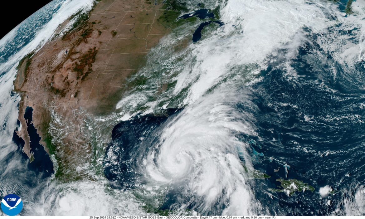
Tropical Storm Erin Could Rapidly Strengthen Into Major Hurricane


Popular Articles

SNL Star Marcello Hernández Returns to Miami for Two Shows at Hard Rock Live

Who’s Performing at the 2026 FIFA World Cup Final Halftime Show? Justin Bieber, BTS & More

World Cup Fever Is Peaking: England, Argentina, Spain and France Are Your Final Four

The Final Four Are In: ‘Love Island USA’ Fans Are One Step Closer to Crowning Season 8’s Winners

Giant Soccer Balls Have Taken Over Miami Beach—And It’s One of the Coolest Things to Do This Weekend